Ever since I was a teenager I've dreamed of going to Lilith Fair. It's basically an all-girl pop/rock/alternative music concert held in the late 1990s.
When I heard that Lilith Fair was back and coming to the DC area I was ecstatic ... once I found out that Missy Higgins was going to be at Merriweather I knew I had to go.
Missy Higgins isn't very well known in the US, so she was on one of the side stages. That was great, because it allowed me to get really close to stage and take some great pictures. Here's Missy:
Sara Bareilles was playing on the main stage when we came back from watching Missy and I just have to say, Wow! Of course I'd heard her songs on the radio, but it wasn't until I heard her live that I realized she actually has a really great voice.
Cat Power was up next, but that wasn't really our thing so we left to get something to eat. Merriweather has lots of lawn seating so even though we had assigned seats, we got comfortable on the lawn while we ate our dinner.
Funny rooster statue in front of the Barns:
Courtyard Hounds (two of the Dixie Chicks) and the Indigo Girls were up next. They had some pretty catchy tunes so that was a lot of fun. The crowd really got into it.
The night ended as it always does, with the fabulous Sarah McLachlan:
She invited everyone back on stage, first just a couple at a time, until the final song of the night when she invited everyone to come out and sing with her. What a great night! Can't wait until next time :)
Trip summary:
Rating: 9/10
Distance: 28mi
Time spent: 7 hours
More information: http://www.lilithfair.com/
Tuesday, August 3, 2010
Wednesday, June 23, 2010
Calvert Cliffs
Calvert Cliffs State Park is located on the Chesapeake Bay. There are a number of trails, but the most popular leads to a small beach on the Bay. It's known as one of the best places to find shark's teeth and fossils.
The trail always stays close to a small stream that becomes wider the closer you get to the bay.
Lots of butterflies along the trail.
It's interesting to see the change in the plants as you hike through the different zones. You start out in the woods, then the trail passes along a series of marshes until finally it ends at the bay.
Water lillies:
There used to be a viewing platform about halfway on the trail, but as you can tell from this picture it's very rickety and it was blocked off when we were in the park in August 2010.
Another view of the freshwater marshland:
After you've been walking for a while the trees suddenly disappear and you find yourself on the narrow beach.
Of course, the cliffs are the main attraction! I had to walk into the Bay with my camera to get this shot:
And the cliffs on the other side:
The small streams runs into the bay on the beach. I found a teeny tiny little water snake there. He was only about a foot long.
A pretty blue dragonfly:
The little watersnake never went far from the water.

As you can tell from this picture the beach really is very narrow and it's not very long either. We've never had a hard time finding a spot to lie down though .. it's a very quiet area. Both ends are "blocked off" where the cliffs start because of the danger of erosion.
The water is very quiet, but there is no lifeguard on duty. The Bay is also known to have some of the most polluted water in the area so swim at your own risk.
If you look to your right after coming onto the beach you'll be able to spot the Cove Point lighthouse in the distance.
We spent several hours sifting through the sand and found a shark's tooth, ray dental plates and several small fossils. Yay! Shark's tooth safely put away it was time to head back to the parking lot.
This little squirrel really wanted to have his picture taken.
I saw this beautiful bird sitting in a dead tree in the marshland. I wish I knew what kind of bird it is ... any ideas?

I love the contrast of the dead trees against the lush green forest in the background.
The trail on the way back. We saw a long black snake slithering across the path, but unfortunately it disappeared before I had a chance to take its picture.
There's a recycled tire playground next to the parking lot, so if you have little ones with you make sure to set some time aside for them to run around and play on the tires.
Trip summary:
Rating: 8/10
Distance: 50 mi
Time spent: 4 hours
Entrance fees: $5 per car
Trail hiked: red trail - 1.8mi
More information: http://www.dnr.state.md.us/publiclands/southern/calvertcliffs.asp
The trail always stays close to a small stream that becomes wider the closer you get to the bay.
Lots of butterflies along the trail.
It's interesting to see the change in the plants as you hike through the different zones. You start out in the woods, then the trail passes along a series of marshes until finally it ends at the bay.
Water lillies:
There used to be a viewing platform about halfway on the trail, but as you can tell from this picture it's very rickety and it was blocked off when we were in the park in August 2010.
Another view of the freshwater marshland:
After you've been walking for a while the trees suddenly disappear and you find yourself on the narrow beach.
Of course, the cliffs are the main attraction! I had to walk into the Bay with my camera to get this shot:
And the cliffs on the other side:
The small streams runs into the bay on the beach. I found a teeny tiny little water snake there. He was only about a foot long.
A pretty blue dragonfly:
The little watersnake never went far from the water.

As you can tell from this picture the beach really is very narrow and it's not very long either. We've never had a hard time finding a spot to lie down though .. it's a very quiet area. Both ends are "blocked off" where the cliffs start because of the danger of erosion.
The water is very quiet, but there is no lifeguard on duty. The Bay is also known to have some of the most polluted water in the area so swim at your own risk.
If you look to your right after coming onto the beach you'll be able to spot the Cove Point lighthouse in the distance.
We spent several hours sifting through the sand and found a shark's tooth, ray dental plates and several small fossils. Yay! Shark's tooth safely put away it was time to head back to the parking lot.
This little squirrel really wanted to have his picture taken.
I saw this beautiful bird sitting in a dead tree in the marshland. I wish I knew what kind of bird it is ... any ideas?

I love the contrast of the dead trees against the lush green forest in the background.
The trail on the way back. We saw a long black snake slithering across the path, but unfortunately it disappeared before I had a chance to take its picture.
There's a recycled tire playground next to the parking lot, so if you have little ones with you make sure to set some time aside for them to run around and play on the tires.
Trip summary:
Rating: 8/10
Distance: 50 mi
Time spent: 4 hours
Entrance fees: $5 per car
Trail hiked: red trail - 1.8mi
More information: http://www.dnr.state.md.us/publiclands/southern/calvertcliffs.asp
Wednesday, June 16, 2010
Random critters
A bunny and two (male) cardinals. The bunnies love the wild strawberries that grow in our yard. 
A Fiery Searcher beetle:
Dragonflies on the porch.
One day I walked out of the house and heard something rustling in the leafs. It was a cute little toad ... but what's it doing?
Aha! Poor baby had gotten caught by a snake.
Eventually the snake let go of the toad and it was able to hobble to safety! The snake slithered away then stopped and stuck out its forked little tongue at me, before continuing into the bushes.
Our resident groundhog, George.
He gets spooked easily so it's hard to take good pictures of him. Here's one of him running to safety after he caught sight of me:
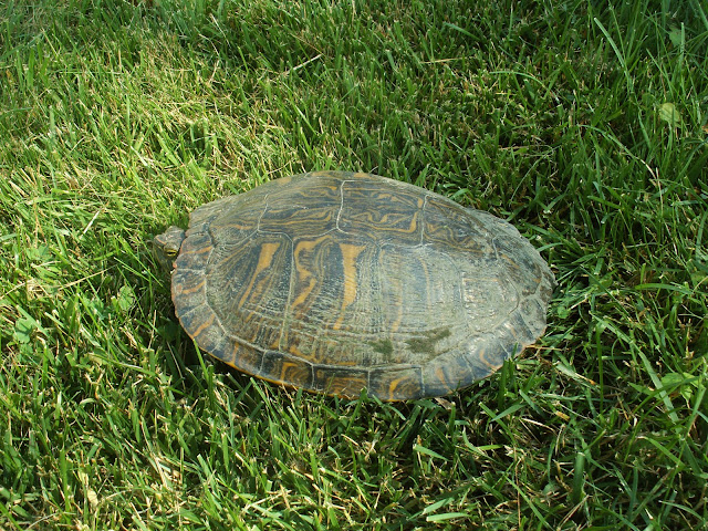
There are lots of turtles in the neighborhood because of the water nearby, but it's not often we find them on the lawn.
They don't move to fast so it's easy to get a close up:
A beaver in one of the city lakes.
I'll try to post new animal pictures every few months or so.

A Fiery Searcher beetle:
Dragonflies on the porch.

One day I walked out of the house and heard something rustling in the leafs. It was a cute little toad ... but what's it doing?
Aha! Poor baby had gotten caught by a snake.
Eventually the snake let go of the toad and it was able to hobble to safety! The snake slithered away then stopped and stuck out its forked little tongue at me, before continuing into the bushes.
Our resident groundhog, George.
He gets spooked easily so it's hard to take good pictures of him. Here's one of him running to safety after he caught sight of me:
I found this beetle in the yard one day and haven't seen in since. It's a black and white spotted Leopard Moth.
There are lots of turtles in the neighborhood because of the water nearby, but it's not often we find them on the lawn.
They don't move to fast so it's easy to get a close up:
A beaver in one of the city lakes.
I'll try to post new animal pictures every few months or so.
Tuesday, June 15, 2010
Monocacy
Monocacy is one of the lesser known National Battlefields, although if we are to believe the ranger at the visitor center, the battle fought here was just as important.
In what would turn out to be the final confederate invasion of the northern states, the greatly outnumbered union soldiers bought valuable time by holding up the confederates at Monocacy. Although the confederate attack was only delayed by one day, this allowed additional union forces to move into Washington DC and save the capital.
This is Best Farm seen from the road. I don't think it's a true working farm anymore, but it was surrounded by fields of corn. In fact, the park is formed by several farms so it's a nice drive through the fields.
Although Monocacy does offer a few walking trails, the points of interest are spaced quite some distance apart and require you to drive from one to the next. I highly recommend stopping by the visitor center to pick up a free map, because there aren't always signs to direct you.
Pretty flowers on the side of Best House. I think it's some kind of lily? There are no walking trails at Best Farm so after a walk around the buildings we drove to the next stop.
The turn off for Monocacy Junction isn't clearly marked and looks more like an exit than an entrace, so pay close attention as you're approaching the river. There is a pull off on the other side of the bridge, but there is no way to get to the other side of the river from there. There is a very steep and slippery slope (I'd only recommend it if you're wearing sturdy hiking boots and are descendant of a mountain goat haha) that leads down to the water's edge for an up close view of the bridge. To be honest, a nicer and more accesible viewpoint can be found at tour stop #5.
Now, back to Monocacy Junction, if you do miss the turn off, don't fret. It's basically a parking lot overlooking a large field. A couple of deer were grazing in the far corner of the field, but the only thing that held my attention for more than 10 seconds was the dead snake writhing with maggots. Sorry, kind of gross, but fascinating at the same time ... I'll spare you the picture.
Here we are on the porch of Worthington House, which was used as a field hospital during the battle. It started drizzling when we got there, but we were itching to get out of the car and do some hiking so we threw on a pair of dazzling rain ponchos and headed out.
For a short while the trail runs parallel to an overgrown pasture, then it leads into the 'woods,' which at that point is really just a narrow strip of trees bordered by the pasture on one side and the Monocacy river on the other.
Word of warning; the soil here is mostly clay and incredibly slippery when wet.
I had hoped that the trail would run right next to the river, but there's about 30 feet of dense underbush to cross before you reach the (steep) river bank. I followed a deer trail down to the river and scrambled down to take a few pictures. The one above is acutally just an 'inlet,' the actual river is much, much wider.
The world's most disgusting mushroom. It's looks just like a pile of rubbers, ick!
Mind your footing on the way back to the parking lot; while not as slippery, the path has more roots than you can shake a stick at.
It has fortunately stopped raining, but it is super humid so we decide against walking the other trail at Worthington Farm and instead drive to the next stop, Thomas Farm.
Typical red barn.
They were growing a number of different crops. Couldn't really tell you what they were growing though, other than corn and wheat.
I love the wheat! It is so beautiful :)
Our last stop on the tour was Gambrill Mill. The water wheel used to be located inside the house ... not sure if it still is or not.
Pond by the mill.
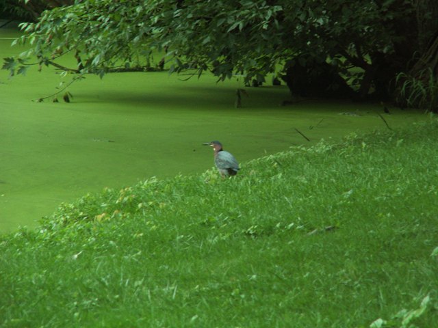
Green heron at the edge of the pond.
Lots of Canadian geese by the pond. Their babies are getting pretty big!
Part of the trail by Gambrill Mill is wheelchair accesible.
Halfway down the trail, there's an easy access (non-wheelchair accessible) to the river from where you can see the bridge. We saw a 3 foot water snake, but it swam away before I could take a picture.
Right before the trail turns back to the barn, there's a short path leading to one of the streams feeding into the Monocacy River. Quite a beautiful spot to end your visit to Monocacy.
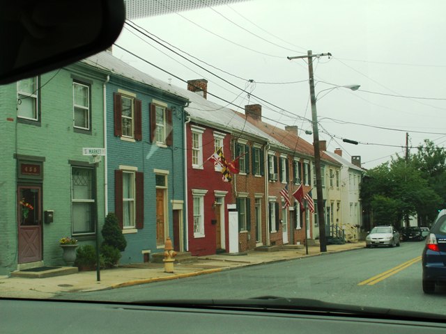
Downtown Frederick. Here you'll find more quirky furniture and consignment shops per square mile than almost anywhere. Next time we'll go explore the old city streets and grab a bite to eat. I saw a beautiful stained glass lamp, but unfortunately the store was closed ... probably just as well since we only brought enough small change for parking to last us 15 minutes.
I love unusual road signs like this one!
Trip summary:
Rating: 7/10
Distance: 45 mi
Time spent: 4 hours
Entrance fees: free
Trail walked: Ford loop trail, Gambrill mill trail, Thomas farm loop trail (partial).
More information: http://www.nps.gov/mono.
Subscribe to:
Comments (Atom)


