Showing posts with label national parks. Show all posts

Tuesday, June 15, 2010

Monocacy

Monocacy is one of the lesser known National Battlefields, although if we are to believe the ranger at the visitor center, the battle fought here was just as important.


In what would turn out to be the final confederate invasion of the northern states, the greatly outnumbered union soldiers bought valuable time by holding up the confederates at Monocacy. Although the confederate attack was only delayed by one day, this allowed additional union forces to move into Washington DC and save the capital.


This is Best Farm seen from the road. I don't think it's a true working farm anymore, but it was surrounded by fields of corn. In fact, the park is formed by several farms so it's a nice drive through the fields.

Although Monocacy does offer a few walking trails, the points of interest are spaced quite some distance apart and require you to drive from one to the next. I highly recommend stopping by the visitor center to pick up a free map, because there aren't always signs to direct you.


Pretty flowers on the side of Best House. I think it's some kind of lily? There are no walking trails at Best Farm so after a walk around the buildings we drove to the next stop.

The turn off for Monocacy Junction isn't clearly marked and looks more like an exit than an entrace, so pay close attention as you're approaching the river. There is a pull off on the other side of the bridge, but there is no way to get to the other side of the river from there. There is a very steep and slippery slope (I'd only recommend it if you're wearing sturdy hiking boots and are descendant of a mountain goat haha) that leads down to the water's edge for an up close view of the bridge. To be honest, a nicer and more accesible viewpoint can be found at tour stop #5.

Now, back to Monocacy Junction, if you do miss the turn off, don't fret. It's basically a parking lot overlooking a large field. A couple of deer were grazing in the far corner of the field, but the only thing that held my attention for more than 10 seconds was the dead snake writhing with maggots. Sorry, kind of gross, but fascinating at the same time ... I'll spare you the picture.


Here we are on the porch of Worthington House, which was used as a field hospital during the battle. It started drizzling when we got there, but we were itching to get out of the car and do some hiking so we threw on a pair of dazzling rain ponchos and headed out.


For a short while the trail runs parallel to an overgrown pasture, then it leads into the 'woods,' which at that point is really just a narrow strip of trees bordered by the pasture on one side and the Monocacy river on the other. 

Word of warning; the soil here is mostly clay and incredibly slippery when wet.


I had hoped that the trail would run right next to the river, but there's about 30 feet of dense underbush to cross before you reach the (steep) river bank. I followed a deer trail down to the river and scrambled down to take a few pictures. The one above is acutally just an 'inlet,' the actual river is much, much wider.


The world's most disgusting mushroom. It's looks just like a pile of rubbers, ick!


Mind your footing on the way back to the parking lot; while not as slippery, the path has more roots than you can shake a stick at.

It has fortunately stopped raining, but it is super humid so we decide against walking the other trail at Worthington Farm and instead drive to the next stop, Thomas Farm.


Typical red barn.

They were growing a number of different crops. Couldn't really tell you what they were growing though, other than corn and wheat.

 I love the wheat! It is so beautiful :)

Our last stop on the tour was Gambrill Mill. The water wheel used to be located inside the house ... not sure if it still is or not.

Pond by the mill.


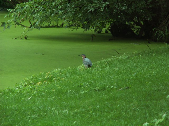
Green heron at the edge of the pond.


Lots of Canadian geese by the pond. Their babies are getting pretty big!


Part of the trail by Gambrill Mill is wheelchair accesible.


Halfway down the trail, there's an easy access (non-wheelchair accessible) to the river from where you can see the bridge. We saw a 3 foot water snake, but it swam away before I could take a picture.


Right before the trail turns back to the barn, there's a short path leading to one of the streams feeding into the Monocacy River. Quite a beautiful spot to end your visit to Monocacy.


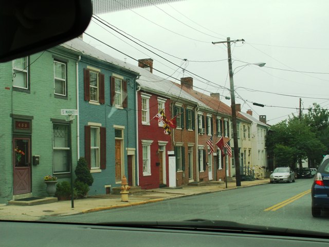
Downtown Frederick. Here you'll find more quirky furniture and consignment shops per square mile than almost anywhere. Next time we'll go explore the old city streets and grab a bite to eat. I saw a beautiful stained glass lamp, but unfortunately the store was closed ... probably just as well since we only brought enough small change for parking to last us 15 minutes.


I love unusual road signs like this one!


Trip summary:

Rating: 7/10
Distance: 45 mi
Time spent: 4 hours
Entrance fees: free
Trail walked: Ford loop trail, Gambrill mill trail, Thomas farm loop trail (partial).
More information: http://www.nps.gov/mono.

Wednesday, March 31, 2010

Cherry Blossom Festival

Spring is here!

Every year, for a period of about two weeks, millions of tourists from all over the world flock down to the DC area to watch the annual cherry blossom festival. They have been in DC since 1912, when Japan sent more than 3,000 cherry trees as a symbol of friendship. DC residents quickly fell in love with the pink and white blossoms, and so did the tourists.


Photographers love taking pictures of the cherry blossoms with the monuments in the background. Of course, I joined right in. This is the Thomas Jefferson Memorial -- more about that later.

Armed with a podcast from the Washington Post, with fun facts about the blossoms, we started our tour of the tidal basin. The plan was to go out on the water with a paddle boat, but because of the fierce winds they weren't letting people on the water initially.


Our first stop: the tulip library! Although planted by the National Park Service, the tulips (more than a 100 different varieties) are imported from the Netherlands. Unfortunately, it was too early for most of the tulips to bloom, but apparently it's quite nice when you get there at the right time.

Pretty in pink!


Another DC landmark; Washington Monument, also known as the obelisk.


Our tour led us part the Franklin Delano Roosevelt Memorial (here pictured with his dog Fala), where somehow I'd never been!


The FDR Memorial is one of the largest in the area and quite enjoyable to walk through with all its waterfalls.


The memorial is dvided in 5 different rooms, that follow the timeline of FDR's presidency. I believe this wall sculpture shows his inauguration.


This sculpture depicts people waiting in line for bread during the Great Depression. Once sworn into office, FDR quickly set to work to boost the economy and create jobs with a now famous program known as the New Deal.

Time to see some more cherry blossoms. I love the reflection of the blossoms in the puddle!

A beautiful overview of the trees near the Jefferson Memorial.

Another memorial I'd never visited before: the George Mason Memorial. It's nice, but a bit of a let down after the grandeur of the FDR Memorial.

Another angle.

Inside of the Jefferson Memorial.

Here you can clearly see some of the neo-classical architecture that's prevalent in DC.

After completing our loop around the tidal basin, we hop on the free shuttle around East Potomac Park. We'd plan to get off at a couple of the stops, walk around, take some pictures, then get back on, but after walking all day on my banged up knee, it's really nice to sit and enjoy the scenery and we end up riding all the way to the second last stop. The picture above was taken in the Park, where trees line both sides of the street.

This is what they look like up close.

Rather than wait half an hour for the next bus we decide to walk back to the mall and I ended up taking this picture of the Washington Monument across the Washington Channel. Not an angle you see very often.

For dinner we head to Chef Geoff's, a restaurant that came highly recommended on a Dutch forum I belong to. The restaurant is located on Freedom Plaza, with the beautiful statue of Brigadier Casimir Pulaski. It's a favorite hang out for local skaters ... if you have a few minutes to spare it's nice to sit and watch them do their tricks.

Anyway, dinner was great! Our favorite were the Buffalo mozarella risoto balls! Hmm so good ... I could've eaten 10 of them.

At night the National Park Service holds free lantern walks among the cherry blossoms and I'd really been looking forward to it. We almost joined a tour during the afternoon, but decided it would be too much to do both ... well, after walking all day anyway my knee was just done, plus it was getting chilly, so we decided to call it a day.

People relaxing on the grass, with the Capitol and the Smithsonian in the background.


Sunset

Trip Summary:
Rating: 7.5/10
Distance: 0 mi
Time spent: 7 hours
Entrance fees: free


Monday, March 22, 2010

Great Falls and Manassas Battlefield Park

After the somewhat disappointing visit to Antietam, we decided to pay another visit to our favorite battlefield park. With rolling acres as far as the eye can see and relatively few roads crossing the park Manassas is in my opinion a lot nicer ... although I will say the visitors center doesn't come close to the one in Antietam.

Anyway, first we make a quick stop at Great Falls ... another National Park. It's a favorite with local rock climbing enthusiasts.


You won't see me scaling those rocks anytime soon, but I can't resist this fallen tree leading to a small island in the river.

I'm embarrassed to admit that I managed to trip over my own feet on a graded section of the gravel trail to the first overlook and take a chunk out of my knee. Didn't look too bad, but I'd hate to make someone queasy, hence the picture of it bandaged up.

At least the view is worth it!  


We make it to viewpoint three without getting my knee looked at, but at this point I'm starting to scare small children so we head to the visitors center to get it cleaned. The woman at the front desk takes one look at my knee and decides that the first aid kit is not going to cut it and she calls a park ranger to take care of me. Can't remember her name, but she told me all kinds of good stories about people doing stupid stuff haha!

I'm all bandaged up so we get back on the road to Manassas.


I love this place!


We'd love to watch a civil war reenactment sometime, but somehow we always miss them. They actually had one the day we were there, but it was long over by the time we got there ... we did see these people in period clothing hanging out. Pretty neat!


Wooden Henry House has been recently renovated.


Beautiful clearing. My knee's throbbing a bit, but I push on and we end up going for a long walk through the woods.


Deeper in the woods it's hard to tell that spring has arrived.


And we're back!


We get back in the car and drive across the road to Chinn Ridge. Pictured here is the Benjamin Chinn house site, but not much is left of it.


Hey, what's that?! 7 Deer in the clearing


Trip summary:
Rating: 8.5/10
Distance: 43 mi (Great Falls 17 mi ; Manassas 27 mi)
Time spent: 8 hours
Entrance fees:  Great Falls: $5 per car; or $3 per person - Manassas Battlefield: $3 per person
More information: